ISTRAM : n°#1 for civil engineering
With more than thousands of registered, Istram is the most comprehensive set of tools on the market.
Also features an tools for quality control!
It includes all the usual steps work on a project:
mapping and field data, design and management of geometries,
measurement, monitoring and control.
ISTRAM’S modules :
- 3D DIGITAL CARTOGRAPHY
- HIGHWAYS
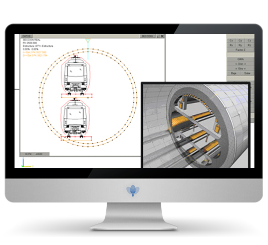
- RAILWAY PROJECTS
- PIPES
- TUNNELS (Design and Construction)
- Improvement and Expansion
- SURFACE MODELLING
- 3D Virtual Module
- GEOGRAPHIC INFORMATION SYSTEM (GIS)
- Beams Design
- Compensación de Tierras
- GIS Infrastructure Conservation

The possibility of always having available manuals
We provide the latest version of a programme or the personal attention of a technician, endorse the quality we offer in addition to the power and versatility of our family of products

We have the best support
ISTRAM applications are always alive and available
Unlike other applications that migrate, change versions and disappear, ISTRAM is evolving day to day.
- Contrary to what happens with other products which need to wait for an annual review, our upgrades are available the moment they are programmed.
- Our customers make their own requests for development, counting on a personal and direct attention.